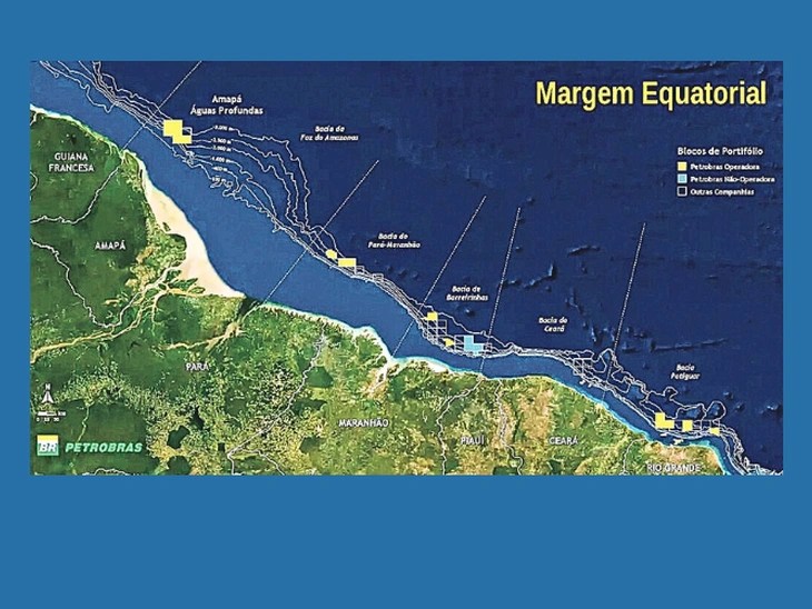
Oct. 2 (TN) The ANP Board of Directors approved (Oct 2) the delimitation of 11 new exploratory sectors in the Brazilian Equatorial Margin—within an area incorporated into the Brazilian Continental Shelf—and the configuration of 501 new exploratory blocks within these sectors. The decision updates the region’s territorial organization following the extension of the Brazilian Continental Shelf’s outer limit, in accordance with a United Nations (UN) decision from March 2025.
The 11 new sectors are distributed across the Barreirinhas, Ceará, Foz do Amazonas, Potiguar, and Pará-Maranhão basins, covering approximately 380,000 km². The 501 blocks configured in these areas are located in water depths exceeding 3,000 meters. The new sectors have been classified as a “New Exploratory Frontier.”
The boundaries of three existing sectors—SFZA-AP4, SPAMA-AUP1, and SPAMA-AUP2—were also adjusted to reflect the new Continental Shelf configuration.
This approval does not mean the 501 blocks will automatically be included in the ANP’s Permanent Offer system. The decision is technical in nature, establishing the areas’ configuration and exploratory classification. Any future nomination of blocks for offer will depend on specific analysis and must follow the applicable regulatory process, including the required evaluations and statements from the ANP and other involved agencies.
This update does not affect existing contracts, as the new areas are not yet under contract.
The socio-environmental analysis conducted for the configuration of the new areas took conservation units into account and identified no overlaps or proximity issues that would render the proposed boundaries unfeasible. Extension of the Brazilian Continental Shelf
This expansion is the result of work carried out by the Brazilian State under the Brazilian Continental Shelf Survey Plan (LEPLAC). The effort was coordinated by the Brazilian Navy, with extensive participation from the ANP, and was recognized by the UN Commission on the Limits of the Continental Shelf (CLCS). With the successful conclusion of Brazil’s submission, the area over which the country exercises sovereign rights to explore natural resources on the seabed and in the subsoil has been expanded.
The new configuration aims to technically organize the areas incorporated into the Brazilian Continental Shelf and establish a territorial basis for expanding geological and geophysical knowledge of the region.
Defining sectors and blocks in advance also provides greater predictability for activities that may precede potential contracting—such as the acquisition of seismic, geochemical, and multi-physical data—while also expanding the information available for planning and future decisions by the Federal Government.


Leave a Reply