Petrobras began a new sequence of wind energy measurements on the coast of Rio Grande do Norte (RN), with version 2.0 of the equipment called Bravo – Remote Offshore Wind Assessment Buoy , an improvement in technology that has never been seen in Brazil, developed by its Research and Development Center (Cenpes). The result of a partnership with the Senai Institutes for Innovation in Renewable Energy (ISI-ER) and Embedded Systems (ISI-SE), the project is another relevant step towards the energy transition. The total invested in technology reaches R$11.3 million through Aneel’s Research and Development (R&D) incentive.
“The level of technological maturity of the equipment has advanced and brought good solutions to the limitations found in the first phase of testing. We expect a robust Bravo 2.0 capable of meeting Petrobras’ needs in relation to measuring offshore wind potential in Brazil, being an important lever for us to advance in this new energy source”, says Petrobras’ Director of Engineering, Technology and Innovation, Carlos Travassos.
Travassos highlights that the investment is part of Petrobras’ strategy to lead the energy transition process in the country. “A new R&D project has been discussed with a focus on installing new Bravos at strategic points on the Brazilian coast, in order to increase data sampling and make the survey of wind potential even more reliable”, he reveals.
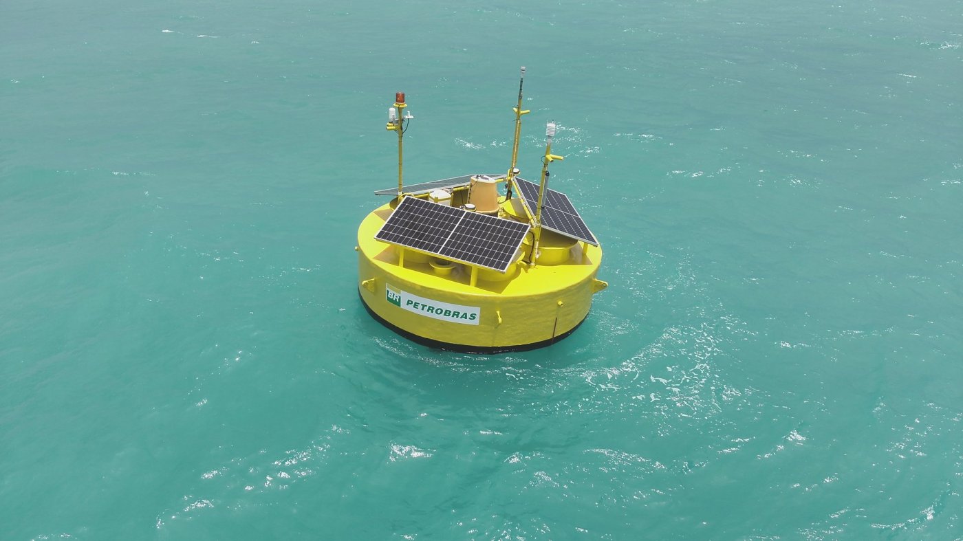
Bravo is a floating Lidar (Light Detection and Ranging) model, developed, for the first time, with national technology. It is an optical sensor that uses laser beams to measure wind speed and direction, generating data compatible with the operating environment of wind turbines. It is also capable of capturing meteorological variables, such as atmospheric pressure, air temperature and relative humidity, as well as oceanographic variables, such as waves and sea currents. All of this data is essential to determine the potential of an area for wind energy production.
According to the director of Energy Transition and Sustainability at Petrobras, Maurício Tolmasquim, “when it is in the commercial stage, Bravo will contribute to increasing the supply of services and reducing the cost of implementing offshore wind projects in the country. Because it is floating, the equipment is easy to transport and install along the Brazilian coast,” he says.
Brave 2.0
In the new version of the equipment, an algorithm, developed especially for the project, allows the information collected to be corrected due to position variations caused by sea swells and marine currents. Bravo 2.0 has also been enlarged to house two Lidar sensors instead of one. This increases the collection of data that is transmitted to a cloud server, through satellite communication, to be later analyzed.
The equipment weighs 7 tons, is 4 m in diameter, 4 m high and is powered by solar energy modules. It will be launched 20 km off the coast of Rio Grande do Norte, with support from the Brazilian Navy and the Intersal consortium, which operates the Areia Branca Salt Terminal. The testing and measurement campaign runs until March 2024.
The information collected by the buoy will be compared with reference data obtained by a fixed Lidar, installed in the same terminal, to validate the functionality and reliability of the equipment’s measurements.

Leave a comment